


TrackMap - NSW app for iPhone and iPad
Developer: Douglas Bocking
First release : 09 Oct 2014
App size: 34.37 Mb
TrackMap - NSW, has been designed to be very simple so persons of any age can use TrackMap - NSW to its full capacity.
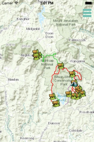
TrackMap - NSW, aims to assist horse riders, mountain bikers and walkers to navigate identified tracks and trails within National parks and State Conservation Areas in NSW.
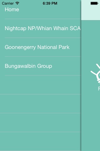
Current National parks and State Conservation Areas included are, Nightcap NP and Whian Whian SCA, Goonengerry NP and Bungawalbin Group of Reserves.
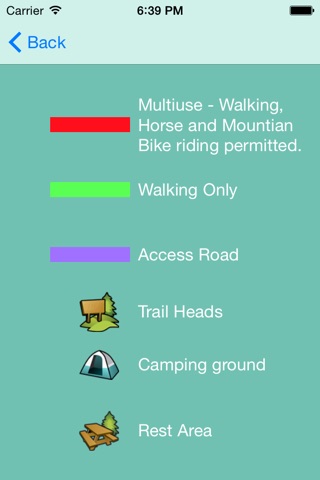
TrackMap - NSW, identifies the user location and points of interest, such as picnic benches, water point, waterfalls and scenic views.
TrackMap - NSW, enhances visitor experience and will help reduce the number of people getting lost in the National Parks areas.
More maps to come in future updates!